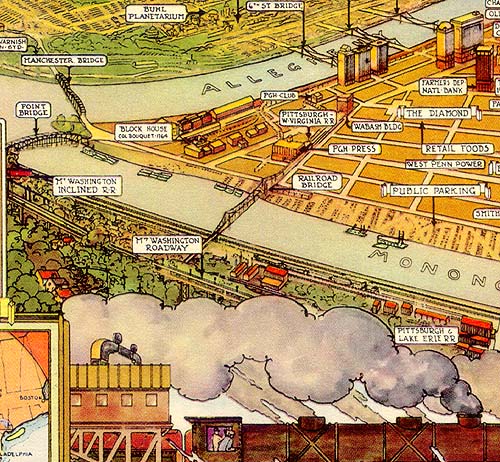
- Caption: Pittsburgh in 1939 (detail).
- Notes: Mt. Washington visible center left.
- Note Manchester Brdige from Manchester to The Point (center), demolished and replaced by Fort Duquesne Bridge.
- Publication of Union Trust Company.
- Note Mt. Washington Inclined R. R., left.
- Note The Point some 20 years before Point State Park.
- Monongahela River at bottom; Allegheny River at top; Ohio River at left.
- A similar scene in 1889.
- Photographer:
- Date: 1939.
- Heading:
- #:
- From the Collections of the Pennsylvania Department,
- Carnegie Library of Pittsburgh.
Last updated: 15 March 1999.